
How GPS Positioning Works in Ankle Monitors
A GPS ankle monitor determines its location by receiving signals from orbiting satellites and calculating the time-of-flight to compute distance from each satellite. With signals from 4+ satellites, the device can calculate latitude, longitude, and altitude. In ideal conditions (open sky, no obstructions), this process delivers 3-5 meter accuracy.
But ankle monitors operate on human ankles — not survey tripods. The device is close to the ground, shielded by the body, and frequently inside buildings, vehicles, or dense environments where satellite signals are degraded. Understanding these real-world limitations is essential for agencies configuring geofences, evaluating alert validity, and selecting devices.
Factors Affecting GPS Accuracy
1. Satellite Constellation and Count
The more satellites a device can receive simultaneously, the better its positioning accuracy. Single-constellation devices (GPS-only) may see 6-12 satellites in open sky but fewer in urban environments. Multi-constellation devices that receive GPS + GLONASS + BeiDou + Galileo have access to 40+ satellites, dramatically improving urban and indoor positioning.
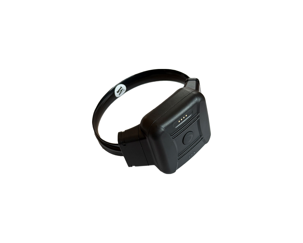
The CO-EYE ONE supports all four major constellations (GPS, GLONASS, BeiDou, Galileo), providing the widest satellite coverage available in a commercial ankle monitor. This quad-constellation approach delivers faster time-to-first-fix and better accuracy in challenging environments.
2. Urban Canyons
Tall buildings reflect and block satellite signals, creating “urban canyons” where GPS accuracy can degrade to 20-50 meters. Multipath reflection — where a signal bounces off a building before reaching the device — can cause the device to report a position offset from its true location.
Mitigation: Multi-constellation GNSS and Wi-Fi positioning. When the device detects that GPS accuracy has degraded, it can supplement with Wi-Fi access point fingerprinting, which typically provides 10-30 meter accuracy in urban areas where Wi-Fi networks are dense.
3. Indoor Environments
GPS signals cannot penetrate most building materials reliably. Inside a concrete or steel-framed building, GPS accuracy may degrade to 50-300 meters or fail entirely. This is the single largest technical challenge for ankle monitor positioning.
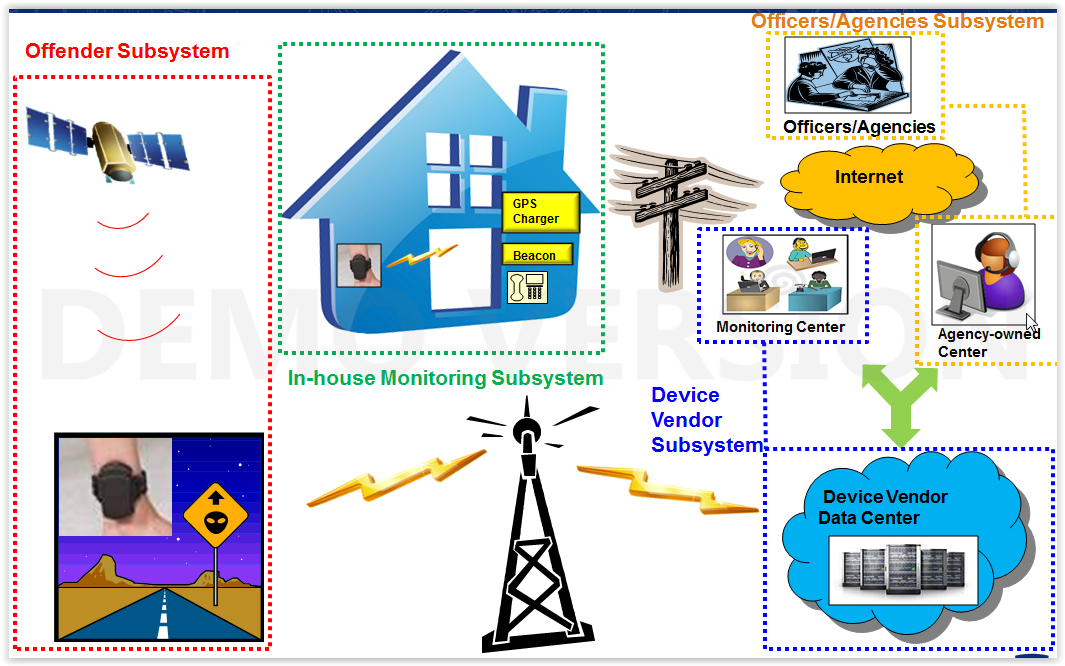
Mitigation: Wi-Fi positioning provides 10-30 meter accuracy indoors by triangulating known Wi-Fi access point locations. Cellular LBS (Location-Based Service using cell tower triangulation) provides 100-1,000 meter accuracy as a fallback when neither GPS nor Wi-Fi is available. The CO-EYE ONE uses a GPS → Wi-Fi → Cellular LBS hierarchy, always selecting the most accurate method available.
4. Dense Foliage and Rural Areas
Heavy tree canopy can attenuate GPS signals, degrading accuracy to 10-30 meters. In rural areas with sparse cellular infrastructure, Wi-Fi fallback is unavailable, and cellular LBS accuracy is limited by the distance between cell towers.
5. Weather
GPS signals pass through clouds and rain without significant degradation. Heavy ionospheric activity (solar storms) can temporarily reduce accuracy across all devices. This is not specific to ankle monitors and affects all GPS applications.
6. Device Antenna and Positioning
Ankle-mounted devices have inherent antenna challenges: the antenna is close to the ground (more multipath from ground reflections), partially shielded by the leg, and oriented downward. High-quality devices use purpose-designed patch antennas optimized for low-elevation satellite reception, while budget devices may use general-purpose antennas with poorer performance in challenging conditions.
Practical Implications for Agencies
Geofence Buffer Sizing
Geofence zones must account for GPS accuracy limitations. Rules of thumb:
| Environment | Expected Accuracy | Minimum Geofence Radius |
|---|---|---|
| Open suburban | 3-10 meters | 50 meters (to avoid false alerts from GPS drift) |
| Urban residential | 10-30 meters | 100 meters |
| Dense urban | 20-50 meters | 150-200 meters |
| Indoor/mixed | 30-100+ meters | 200+ meters (or use Wi-Fi zone instead) |
Setting geofence zones too small creates false zone-violation alerts. Setting them too large reduces the enforcement value. For exclusion zones (sex offender school buffers, DV victim protection), use the state-mandated buffer distance plus at least 50 meters for GPS accuracy tolerance.
Alert Interpretation
Not all zone violation alerts represent actual violations. When interpreting alerts, consider:
- Duration: A single position report inside a zone may be GPS drift. Multiple consecutive reports (10+ minutes) indicate actual presence.
- Trajectory: Did the path approach and enter the zone (genuine approach), or did a single point jump into the zone while surrounding points are outside (GPS scatter)?
- Location method: Was the position determined by GPS (higher accuracy) or Wi-Fi/cellular fallback (lower accuracy)? Good monitoring platforms display the positioning method alongside each location point.
Technology Comparison: Positioning Capabilities
| Feature | Budget Devices | Mid-Range | CO-EYE ONE (Premium) |
|---|---|---|---|
| GNSS constellations | GPS only | GPS + GLONASS | GPS + GLONASS + BeiDou + Galileo |
| Outdoor accuracy | 5-15m | 3-10m | 3-5m |
| Indoor fallback | Cellular LBS only | Wi-Fi + Cellular | Wi-Fi + BLE + Cellular LBS |
| Indoor accuracy | 100-1000m | 15-50m | 10-30m |
| Time to first fix | 30-60 seconds | 15-30 seconds | 5-15 seconds |
Frequently Asked Questions
How accurate are GPS ankle monitors?
GPS ankle monitors achieve 3-10 meter accuracy outdoors in open environments. Accuracy degrades to 20-50 meters in urban canyons (tall buildings) and 50-300+ meters indoors. Multi-constellation devices (GPS + GLONASS + BeiDou + Galileo) like the CO-EYE ONE provide the best accuracy, supplementing GPS with Wi-Fi and cellular positioning when satellite signals are degraded.
Do GPS ankle monitors work indoors?
GPS signals cannot reliably penetrate buildings. Indoor positioning relies on Wi-Fi access point triangulation (10-30 meter accuracy) and cellular tower triangulation (100-1,000 meters). The best ankle monitors automatically switch to Wi-Fi positioning indoors. Some devices also support BLE beacons for room-level indoor accuracy when paired with RF base stations.
How should agencies size geofence zones to account for GPS accuracy?
Minimum geofence radius should be 50 meters in open suburban areas, 100 meters in urban residential, 150-200 meters in dense urban environments, and 200+ meters for indoor/mixed environments. Zones set smaller than these thresholds will generate false zone-violation alerts from normal GPS accuracy variation.
Does weather affect GPS ankle monitor accuracy?
Normal weather (clouds, rain, snow) does not significantly affect GPS accuracy. Heavy ionospheric activity from solar storms can temporarily degrade accuracy for all GPS devices. This is rare and typically resolves within hours. Indoor environments and building materials affect accuracy far more than weather.
What is multi-constellation GNSS and why does it matter?
Multi-constellation GNSS receives signals from multiple satellite systems simultaneously — GPS (US), GLONASS (Russia), BeiDou (China), and Galileo (EU) — providing access to 40+ satellites instead of 12-15 for GPS-only devices. More visible satellites means better accuracy, especially in urban environments and the Asia-Pacific region where BeiDou provides superior coverage.